|
|
|
Day 45: 15 October 2007 |
Bourton-on-the-Water to Shipton under Wychwood |
Map Next Top |
Back to Bourton-on-the-Water for the last time. Considering I'd never been here before 2007, I seem to have spent a lot of time in the place However, on this occasion it was a very fleeting visit.
We'd driven from Pen-y-Gwryd, near Capel Curig in North Wales, 175 miles since breakfast so I was keen to get out of the car and start walking. We arrived about 1 p.m. and I left Chrissy to have another look around the town before continuing to Burford and check in to our hotel.
The Heart Of England Way now behind me, this was the start of the Oxfordshire Way and I picked up the route from the south-eastern end of Bourton. The weather was a mixture of heavy cloud and brighter patches, with the emphasis on the cloud, and there was a fair chance of rain. But it was fairly warm: comfortable walking weather.
There are a couple of other paths as you leave the little housing estate on the edge of town, so I had to be careful to stick to the correct route. This time, I had a fully-charged GPS so there was no real problem.
 |
|
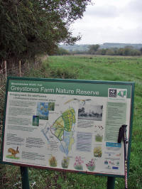
Gratefully entering the wide-open spaces of Gloucestershire and leaving the tarmac behind, I crossed the Greystones Farm Nature Reserve and headed across the fields to the quaint Wyck Rissington. On the way, an ancient "Mound" was marked on the map: but there was nothing in evidence at the site.
Entering Wyck Rissington, I was approached by a group of young girls. They were clearly out for a ramble and asked about the shortest route to Icomb. Although I directed them I had to ask why they needed to check, as they seemed loaded down with maps and compasses (as well as back packs). It appeared that they'd lost their route and become so tired and demoralised that they'd given up looking at the map - not the best decision under the circumstances. They set off in the right direction: I hope they made it OK.
 |
|
The village is set around an unusually wide and long green, with a Victorian drinking fountain and classic duck pond.
 |
|
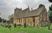
Wyck Rissington is famous for being the home of the composer Gustav Holst, who was organist at the church for a year.
 |
|
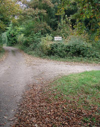
The Way passes through the churchyard, leaving by a little gate at the back. From here, there is a stiff climb up the side of the ridge to Wyck Beacon. A short road section leads to a rather overgrown fenced path to the A424. The road was busy was fast-moving cars, so it was a relief to cross it and enter the Gawcombe estate.
 |
|
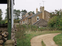
The way descends through pleasant ornamental trees to Gawcombe itself: this appears to be a manor house and farm, with cottages which have the look of being lost in some early-20th century timewarp. There's no tarmac road to the cottages, which have a lovely open view across the rolling countryside. There seems little information about the place either.
 |
|
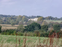
I took a short diversion after Gawcombe, to log a geocache a quarter of a mile from the path. This gave fine views of the rather stark and clean-looking Icomb Place across the valley from the Way. Apparently, the gardens are magnificent but it was too far off-route to visit.
 |
|
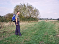
Back on the Way, the next mile was on the most perfect footpath. Gently downhill, with soft but well-mown grass underfoot, the sun now drying the air nicely it was the best walking on the E2 so far. In fact, it stayed very pleasant as the path followed the Westcote Brook and cut across the fields to Bledington.
 |
|
 |
|
 |
|
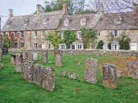
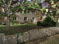
Bledington is another perfect Cotswolds village, with a charming and historic area next to the 15th-century church and a pleasant (though ordinary) section as you leave the village.
 |
|
 |
|
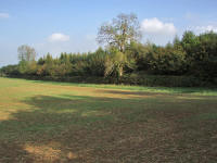
At Foscot (obviously derived from "Foxcote"), I left the road, entered Oxfordshire, and followed a good path across fields and small woods by the Evenlode until crossing another road at Bruern Abbey.
 |
|
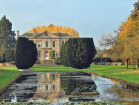
The Abbey was built for Sir John Cope in 1720, although it was rebuilt later after a major fire. The original (disreputable) abbey dates from 1147, but there is no trace of it now. There are holiday cottages on the estate: http://www.bruern-holiday-cottages.co.uk/history/.
 |
|
I called Chrissy on the mobile to let her know that I'd be arriving on time: we were to meet in Shipton at 5. As the Bruern grounds were very scenic on such a fine afternoon, I had to hurry along once I left them as I'd dawdled a while admiring the beautiful house and surroundings.
The evening was spent at the immaculate Bay Tree Hotel in the typical Cotswold village of Burford. Expensive, but worth it.
Day 46: 16 October 2007 |
Shipton under Wychwood to Charlbury |
Map Next Top |
As we were heading to the Dorset coast today, there wasn't enough time for a full day's walk. So it was only to be a 7 mile section from Shipton to Charlbury. This would put me in a good position, however, as Charlbury is accessible by train from Birmingham Airport. I'd planned another visit to the E2 in November: this time on my own and using the train services. So it would be very useful to get this short section complete, leaving me with a day's walk from Charlbury to Oxford.
 |
|
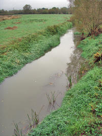
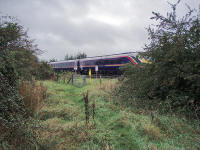
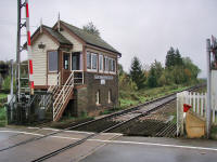
By 9.45 I'd been dropped off back in Shipton: Chrissy continued to Stow to resume her shopping expedition there. The weather was dull, and threatened rain, so I made sure that waterproofs were being carried. The Evenlode looked heavy and cloudy with recent rain. After an uneventful mile and a half, enlivened only by a perilous level crossing, I was in the long village of Ascott-under-Wychwood. The western end of the village is called Ascott Earl and the eastern Ascott D'Oyley. Very quaint, and there's the remains of a castle at each end of the village, although neither is much in evidence nowadays.
 |
|
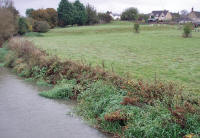
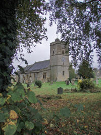
The Oxfordshire Way takes a route along the main street: I noticed that the pub is being extensively refurbished and will be an attractive prospect when complete.
 |
|
 |
|
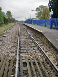
Another level crossing (adjacent to the station) leads out of the village: there's a great view of the long straight line heading for London here.
 |
|
 |
|
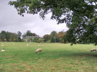
A pleasant section followed, with views of the classic mansion of Pudlicote. I think that this is just a farmhouse but it's very grand.
 |
|
The Way continues through attractive but unremarkable countryside, until the next feature of note: Dean Common. This is being restored from a former sand and gravel pit by Greenways Waste Management, to provide a community woodland along with wetland and limestone grassland habitats. It's known as the Wychwood Project, and it's certainly producing some interesting countryside.
 |
|
Admiring the copses and grassland, I missed a turn on the path but this didn't matter and I was able to rejoin after a short diversion. The sun was now breaking through the cloud layer, and the air was becoming warmer and less humid. It was a shame not to be able to dawdle, but Charlbury beckoned.
 |
|
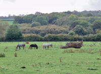
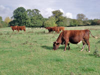
Approaching this small town through pastures and fields, it was easy walking and simple to follow the path.
 |
|
By midday I was striding along the main street: Chrissy was delayed in traffic so I had a short wait, but this wasn't too much of a hardship in the sunshine. I'm now coming to the end of the Cotswolds section: it's been good walking - generally easy going with good paths and signposting (although I haven't seen a single E2 marker). The countryside has been consistently interesting: there is rarely an ugly view and even if there's nothing like a major climb there are a surprising number of short and steep ascents and quite a bit of land that feels high and open.
I'll be back in November - looking forward to heading into the Thames Valley and breaking the 700 mile mark!.
 |
|
From the Charlbury Visitors' Guide;
Charlbury is situated 15 miles north west of Oxford in the beautiful Evenlode Valley, surrounded by glorious Cotswold countryside and the historic towns of Woodstock, Burford and Chipping Norton. Charlbury is a small market town, typical of the Cotswolds, with its colourful cottage gardens and houses built of local materials. To the south west of Charlbury lies the remainder of the ancient Wychwood Forest, part of which now makes up the estate of Cornbury Park. Monarchs once exercised their exclusive hunting rights in the forest. Today, deer and other wildlife can still be spotted from public footpaths that border the Park. The coming of the railway in 1853 put new life into the market town. Charlbury still has its picturesque station, the design of which is linked to Isambard Kingdom Brunel. Regular trains link the town to London, Reading, Oxford, and west to Hereford and Worcester.
Day 47: 10 November 2007 |
Charlbury to Oxford |
Map Next Top |
Now the E2 enters a section where public transport can actually be used fairly easily: for the first time along the whole walk! So I was able to visit Oxfordshire without needing the services of Chrissy for driving duties. A Friday night flight brought me to Birmingham Airport, from where there are regular trains to Oxford. So I was at Oxford Station by 8.15, and esconced in the very nice B&B (Tilbury Lodge) by 9.
In the morning, there was time for a quick bite to eat (I had to skip the reputedly excellent Tilbury Lodge breakfast), a wait for a bus, then back to the station for the 8.48 to Charlbury.
Here, the plans looked like going off the rails (literally). The train arrived on time, but after a few minutes there was a rumour that it was going to stop at Oxford. This was soon confirmed, and we were all told to leave the train. I feared the worst, expecting that we'd have to wait at least another hour, and with a long walk planned that would not be good news. In the event, First Great Western did very well, and ten minutes later we were under way on a replacement train.
Arriving in Charlbury only fifteen minutes late, I was soon getting up to full walking speed.
 |
|
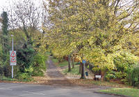
With nearly 23 miles to go, I decided that I'd stride out all morning and try and get close to half way by midday.
 |
|
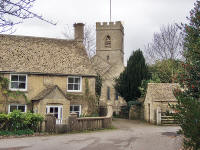
Luckily, the route would be quite suitable for a fast pace, and I was keeping to nearly 4 mph as I took in the pleasant countryside towards Stonesfield (which seems to be named after the very stony fields heareabouts!)
 |
|
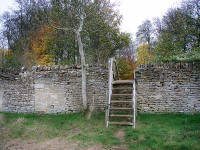
This was still the Oxfordshire Way, and after Stonesfield it takes a bee-line towards Tackley on the Oxford Canal. Not surprising, because it follows the Roman road Akeman Street.
 |
|
Not far after leaving Stonesfield, I passed through the grounds of Blenheim Palace: rather too far north to see much of it though.
 |
|
Here, a shepherd and sheepdog appeared, chasing a stray sheep. Not a very well-trained dog, as it stayed well away from the sheep, eventually deciding to take a dip in a drinking trough rather than assist!
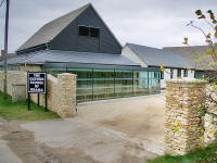
After crossing the very busy A44, I crossed the River Glyme - this seems to mark the end of the Cotswolds. Easy walking along a road took me past the Oxford School of Drama and Sturdy's Castle to a downhill section and the Oxford Canal.
 |
|
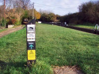
I reached the Oxford Canal Walk just after 12: good timing and nearly 4 mph average. Here, the Oxfordshire Way wanders on east, but I turned south towards Oxford itself.
 |
|
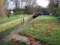
A busy afternoon ensued, as I attempted to log as many geocaches as possible along the way. With about two per mile it was going to slow me right down, but this was an absorbing way to enjoy the trudge along the towpath.
 |
|
 |
|
By the time I approached the outskirts of Oxford the light was failing, but the path is easy and I did have a torch with me. This was pretty necessary for the last mile into the centre of Oxford: there is no lighting and it was pitch dark. But I made it by 5.15, and was soon back on the bus to Tilbury Lodge, where they'd kindly provided a foot spa!
Day 48: 11 November 2007 |
Oxford to Appleford |
Map Next Top |
 |
|
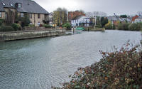
With a reasonable weather forecast, I was in a hurry to get under way: but not so much of a hurry that I was going to miss breakfast! I left Tilbury Lodge and ran for the bus into Oxford. The bus was busy, surprisingly considering it was early on Sunday morning. I alighted at the railway station and walked under the railway bridge to the Thames Path. As I passed under the bridge a few spots of rain fell, but I didn't expect it to amount to more than a few minutes of drizzle. Within five minutes, however, there was a full downpour under way. I'd buried my waterproofs somewhat after checking the forecast, so it was a struggle to get them sorted out before everything became soaked. I'm don't enjoy walking in the rain much either, so I was quite grumpy by the time I started off down the Thames Path!
One of the problems with using public transport for a weekend trip is that you have to carry absolutely everything with you in your rucksack. That doesn't sound too bad: but unless you want to wear muddy boots and trousers the whole time, you need a change of clothes and shoes; if it's likely to be cold you need extra warm clothes for waiting at bus stops and railway stations; and there are cameras, phones, chargers and all the other small but significant accoutrements. Some things get left behind: this time, my walking pole and water bottle had to stay at home (for airport security) and so did my best camera. But I coped...
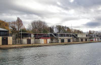
You don't see much of Oxford from the river, surprisingly: it seems to be avoided by the city architects. After passing to the south of the city, there are numerous boathouses and rowing club headquarters and then you get into more open countryside.
 |
|
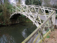
The rain had stopped very suddenly and I was enjoying the good firm towpath and the views of rowers labouring up and down the river. Stopping for a few minutes at Iffley Lock to admire the Mathematical Bridge (a replica of one at Cambridge), I was able to pack away the wet weather gear for the rest of the day.
 |
|
The next lock is at Sandford, where I was hoping for a sight of the infamous Sandford Lasher, a weir that has claimed many lives. The lock has the greatest fall on the Thames and was worth stopping for, but the weir was out of sight beyond trees and I went past it before realising.
This was Remembrance Sunday, and I stopped near Radley at 11 a.m. for a minute. A peaceful spot.
 |
|
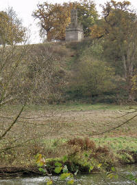
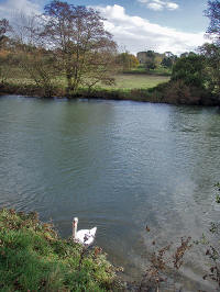
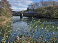
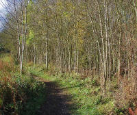
The countryside was becoming very open, with an almost wild feel to it. Past Nuneham House, the path was muddy in places but quiet: I only saw one other person between Radley and Abingdon.
 |
|
 |
|
 |
|
 |
|
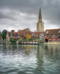
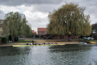
The Thames Path stays on the east bank through Abingdon, whilst the town is all on the west bank. There are good views though, and you pass beneath the bridge: built in 1422 with 14 arches it was critical for the success of Abingdon.
 |
|
 |
|
 |
|
South of Abingdon, the Thames goes south then east to Culham. At Culham Bridge I left the E2 in favour of a dull march along the B4016 to Appleford. Half an hour keeping warm in the village pub was followed by a draughty wait on the station platform: but the train was on time and I was soon back in Oxford. Then another train to Birmingham and a flight to the Isle of Man: all on time too!
 |
|
Day 49: 15 December 2007 |
Appleford/Culham to Goring |
Map Next Top |
Strictly speaking, I should have returned to Culham Bridge and continued from there. But this trip was going to be quite complicated: flight to Birmingham, train to Reading, train to Culham. No problem, except that I would have to arrive at Culham Station, which is a couple of miles along a main road (in the wrong direction!) from Culham Bridge. So I planned to get a taxi or bus from Culham Station to the bridge as I didn't fancy the extra walking: with 18 miles already on the route card via the shortest route it seemed a little too obsessive to both avoid the obvious short-cut (straight along the main road east for a mile to Clifton Hampden) and also add well over three miles to the route (it was nearly two miles to the bridge, followed by another three along the river to Clifton Hampden.
 |
|
I did realise that Culham Station was not a major terminus, so may or may not have taxi and bus connections. In the event, I arrived on time at 07.46 and there was no sign of a taxi - and the bus stop up on the main road indicated a very sketchy service, with nothing imminent. So I was happy to take this as a hint to use the short cut, and off I set down the road to the east.
By the time I reached Clifton Hampden it was light enough to enjoy full views of the countryside (although a little too dark for photos: I only had my little lightweight digital camera and it's difficult to get good photos in very low light).
The village is quite beautiful, with several thatched cottages facing the river and an attractive church set on a bank above the flood plain.
 |
|
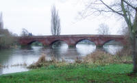
The bridge was designed by George Gilbert Scott, and replaced the ferry when it was built in 1864. The Thames Path uses this bridge to cross, then follows the southern bank along a great bend in the river, slowly turning through pastures from an ENE direction to SSW at Little Wittenham.
 |
|
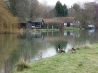
As you pass by Burcot, there are many superb and grand riverside houses, with big grounds leading down to the boathouses. Dorchester is hardly visible from this side of the river, however,
 |
|
The weather was rather grey and uninviting, with frost on the ground in places and a slight but chill breeze from the east. But I was well-prepared with clothing and didn't feel cold at all.
 |
|
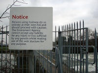
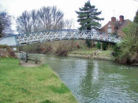
At Day's Lock I re-crossed the river, then crossed again via the footbridge, to explore the little island just below the lock.
 |
|
 |
|
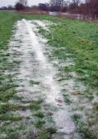
From here, the path turned into a trudge across icy fields until cheery early-morning anglers heralded the approach of Shillingford.
 |
|
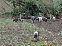
By ten o'clock I'd negotiated the short section of road into Shillingford, and gratefully turned off into the quite village street. Traffic always seems more offensive when you've had a few miles of quiet countryside, and I can hardly wait to get away from the noise and smell of it.
 |
|
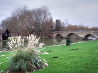
I crossed Shillingford Bridge to briefly explore the other side: there's an outdoor swimming pool here, which looks unlikely on a freezing December morning.
 |
|
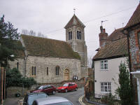
Quickly moving along an anonymous section to Benson (more anglers), I crossed again, this time by a wonderful narrow walkway over the weir. From here, it was just a short section to the more substantial town of Wallingford, with its interesting churches and castle. This is a historic spot, the lowest point at which the Thames could be forded at any time of the year. Now, of course, there's a bridge - in fact there's been one here since 1141.
The path follows Thames Street for a while before rejoining the river bank after taking a route through a passageway between houses. It was noticeable that the houses were built with flint: the Cotswold Stone now long left behind.
 |
|
 |
|
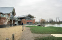
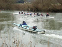
Just south of the town is a huge new rowing complex belonging to Oxford University,
 |
|
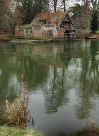
but soon the ancient boathouse at Carmel College appeared on the other bank.
 |
|
 |
|
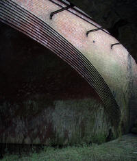
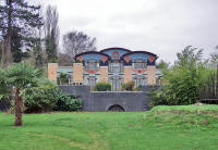
Passing by the impressive Fair Mile Hospital, the path follows the west bank at the side of pleasant meadows (even though the original tow path crosses to the east bank: but there's no ferry any more). After walking under a busy railway, I followed the route away from the river for a while and through Moulsford. With some fatigue setting in, and a rather dull village road, this was a not-very-exciting little detour and I was pleased to rejoin the river after a mile or so. Here there's a huge modern house with remarkable architecture: perhaps of Egyptian influence.
 |
|
 |
|
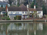
Approaching Goring, the river flows through an attractive shallow gorge (the Goring Gap), with lovely houses dotted about. The Gap dates from the Ice Age, when the river cut through the Chilterns to reach the route to London.
 |
|
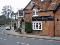
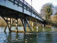
Crossing to the east bank via the long bridge, I left the Thames Path in favour of Goring Railway Station and the return to Reading. Unfortunately, the train was late and Goring Station has no facilities at the weekend: not even a waiting room or toilets. So I had a freezing forty-five minutes on the platform until transport arrived. But a pleasant evening in Reading (staying at the excellent refurbished Novotel) restored by spirits and got me prepared for a lighter day.
 |
|
Day 50: 16 December 2007 |
Goring to Reading |
Map Next Top |
No need for an early start today, with a train from Reading to Birmingham at 16.40 and only 13 easy miles to walk. So I had a lie-in and a leisurely breakfast at the superb Novotel (N.B. they do a great weekend rate!). But as these things tend to, this led to a mad dash to the station and I was on board the train to Goring with only two minutes to spare.
 |
|
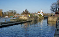
The weather was perfect: cold, but very bright with a clear blue sky and hardly a breeze at all. I should have planned a longer walk today! Quickly making my way back down to the river, I had to remind myself to take a more leisurely pace so that I wouldn't end up kicking my heels in Reading for half the afternoon.
 |
|
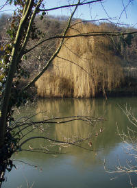
It was easy enough to slow down, because straight away the footpath was diverted from the collapsed riverbank and into the village. Taking in the local geocaches, I followed the trail back to the river, out of this lovely village and through the ice-age created Goring Gap.
 |
|
Across the river, big birds of prey circled elegantly. I assumed them to be buzzards - the first I'd seen since Scotland - but later checking confirmed that they were Red Kites. These are regarded as rare sights, but there are clearly no shortage along the Thames - magnificent.
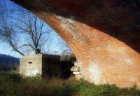
After a flat section of routine flood plain, the path passed under a superb Brunel-built railway viaduct and into more interesting country.
 |
|
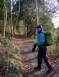
Walking the section past the old Gatehampton Ferry Cottage (where the old tow path crosses but the Thames Path strays from the bank) was one of the best parts of this year's E2.
 |
|
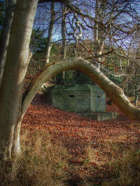
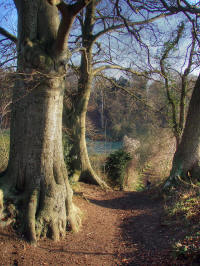
A super path through Hartslock Wood led steadily uphill until an open section with great views into the Chilterns.
 |
|
 |
|
 |
|
 |
|
 |
|
 |
|
 |
|
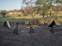
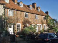
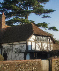
Eventually, I was strolling through the picturesque village of Whitchurch-on-Thames: then across the toll bridge (free for pedestrians) and onto the riverside meadow of Pangbourne. This was well-frozen, and an excursion across it away from the path was a lot drier than it could have been!
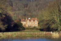
The Tudor Hardwick House is visible briefly:
this is one of
the oldest houses in the Thames valley and thought to be the inspiration for
Toad Hall.
 |
|
After Mapledurham Lock, the path turns "inland" and through Purley on Thames. The route is through a housing estate: pleasant enough, but I was concerned about getting lost in the maze of streets and took the first escape to the main road. This was a more obvious way but much less enjoyable and I wished I'd stuck to the proper line.
Eventually, I turned off at a Thames Path sign beside a hotel (closed for refurbishment), then down steps via a railway footbridge with spectacular views and back to the river and a "Welcome to Reading" sign.
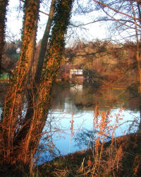
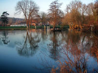
Despite this, there's little evidence of a major town until you actually reach the centre at Caversham Bridge, three miles further along. There's just a very relaxing walk along the burgeoning Thames: today in beautiful red/orange light as the late afternoon sun slowly sank.
 |
|
 |
|
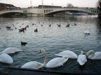
Some fantastic mansions on the opposite bank heralded the built-up part of Reading, and soon I was at the elegant Caversham Bridge. I'd timed it well, with still an hour to reach my train. From this approach, Reading is a very attractive town and doesn't shame the river.
 |
|
One last geocache (outside the station) and my walk was over. I'll be back in January for a three-day hike, ending the E2 section of the Thames Path and heading towards the final chapter of this long ramble.
Day 51: 18 January 2008 |
Reading to Henley |
Map Next Top |
 |
|
 |
|
 |
|
 |
|
 |
|
 |
|
 |
|
 |
|
 |
|
Day 52: 3 May 2008 |
Henley to Bourne End |
Map Next Top |
 |
|
 |
|
 |
|
 |
|
 |
|
 |
|
 |
|
 |
|
 |
|
 |
|
 |
|
 |
|
 |
|
 |
|
 |
|
 |
|
 |
|
Day 53: 20 January 2008 |
Bourne End to Windsor |
Map Next Top |
 |
|
 |
|
 |
|
 |
|
 |
|
 |
|
 |
|
 |
|
 |
|
 |
|
 |
|
 |
|
 |
|
 |
|
 |
|
 |
|
 |
|
 |
|
Day 54: 4 May 2008 |
Windsor to Weybridge |
Map Next Top |
 |
|
 |
|
 |
|
 |
|
 |
|
 |
|
 |
|
 |
|
 |
|
 |
|
 |
|
 |
|
 |
|
 |
|
 |
|
 |
|
 |
|
 |
|
 |
|
 |
|
 |
|
 |
|
Day 55: 5 May 2008 |
Weybridge to Guildford |
Map Next Top |
 |
|
 |
|
 |
|
 |
|
 |
|
 |
|
 |
|
 |
|
 |
|
 |
|
 |
|
 |
|
 |
|
 |
|