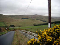
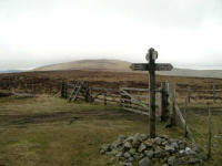
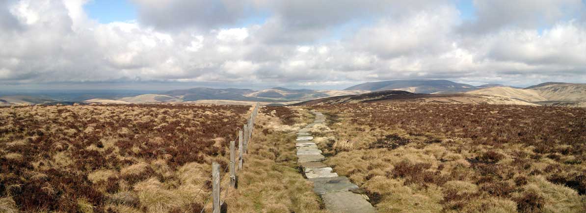
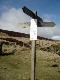
Although the path from Raven's Knowe is almost
all downhill, it is still an effort as there tends to be a flat section over
rough ground followed by a climb down steep rocks, followed by the same again
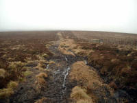
several times. The land around here was extremely swampy as well, with many
areas where careful steps have to be taken to avoid going in over the knees in
green swamp. An unexpected and unwelcome hill finally led to the last descent -
a steep and awkward scramble through the forest on the side of Byrness Hill,
which finishes in a ravine. A short but very steep climb out of the ravine leads
down to the road (the A68), and the sudden shock of houses and speeding cars.
I have to admit to being very weary by the time I trudged up the seemingly steep
drive to the Byrness Hotel. Although I was still capable of a few more miles
before real exhaustion, hill climbing had become a real problem, I guess because
I'm not used to it, not being a regular weekend hill walker. My legs throbbed
for the next couple of hours - alcohol has a great soothing effect though and I
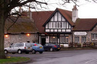
was glad to get a good night's sleep in the rather disappointing Byrness Hotel.
I was in no great hurry to start walking in
the morning - fifteen miles with comparatively few hills sounded like a rest day
after the Cheviot crossing, and it seemed more important to rest and conserve
stamina rather than get to Bellingham early.
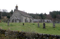 |
Byrness Church
|
So it was after 10 o'clock before I said goodbye
to Chrissy and set off. It was a pleasant morning, mostly cloudy but with a few
small breaks to provide a little optimism for the day ahead. The first two miles
are along the river Rede: a sheltered glen of trees and verdant clearings. At
Blakehopeburnhaugh (the longest name on the Pennine Way!), the track turns in to
the forest - back to Southern Upland type country. An undulating forest track
led SSW for another three miles: ideal for getting the day under way as an easy
rhythm can be attained on the unobstructed, hard packed surface. Just over a
mile from Blakehopeburnhaugh, signs pointed off to the right, where the official
route takes a parallel path along rough ground up a hill, then rejoins after
about half a mile. I don't think there is any need to be pedantic when following
a long-distance path - in cases like these, where the diversion appears
illogical, it's better to ignore it and continue along the main track. That was
my opinion at the time, anyway - nothing to do with just not relishing giving up
the easy walking for an awkward little path, of course!
 |
Blakehopeburnhaugh
|
In any case, the easy walking soon came to an
abrupt halt. The fork to Brownrigg Head appeared to be a good wide path along
the forest edge, but this was an illusion as it was really a narrow, winding and
faint line through a very wet bog. After leaving the trees, the boggy ground
continued up to the top of the hill: progress was in a weaving line with much
stopping and starting to avoid the wettest ground. Although my feet were staying
dry in the Gore-Tex lined boots and gaiters, it was heavy going underfoot and
there was a good chance of sinking in above the knees if one lost concentration.
The ground was firmer over the top, but a steep
descent into the Gorless valley was even wetter. I passed a walker here: the
first of the day.
By half past twelve I was climbing Padon Hill: at
last firm ground. At the top I stepped over the fence and strolled across to the
striking "Pepper Pot" monument. Sadly, the authorities are keen to close the
footpath leading to the monument (I can't imagine why as it's the only striking
feature in the area). I visited the geocache nearby (one of only a few which are
within easy reach of the Way), then stood and had lunch of a few mouthfuls of
water and some Kendal Mint Cake.
 |
The Pepper Pot on Padon Hill
|
Feeling fortified after this extravagant meal, I
marched on to the road across moorland of short heather. After crossing the road
the path became very vague as it entered an area of peat bogs. An elderly lady
was sitting down near the stream which starts on Lord's Shaw. I spoke to her
briefly - she seemed in great spirits considering her diminutive size and the
enormous pack she had obviously been carrying. The sky had turned grey and a
chilly breeze was blowing, so I remarked that the weather was not so good, but
apparently the previous day she'd been caught in a hailstorm and had to walk
against high winds. She didn't mind that, but she'd invited a friend along for
the day who was not so impressed with the walk under those conditions.
The featureless moor of Deer Play followed. At
first the line was difficult to find, or perhaps I was a little off-route
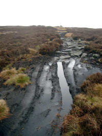
because eventually I reached a wide, rutted track. This is one of the sections
which is severely damaged by off-road vehicles, a great pity as it makes the
path a difficult and unpleasant unpaved roadway although the surroundings feel
wild and natural (of course, they are man-made but still with a wilderness
feel).
 |
Deer Play
|
I passed a group of young backpackers on the
descent to the B6320, who warned me about the boggy "alternative route" ahead.
This takes a more direct line from just west of Hareshaw House to the knoll
above Bellingham, but unfortunately doesn't lead to Hareshaw Linn. The path from
Hareshaw Linn to Bellingham was the original line of the PW, but now it stays
further east, (whether or not you use the alternative) which is a great shame.
The alternative route was a non-starter for me -
I'd had enough of boggy ground anyway, so I turned left and up a short rise to
the Hareshaw House lane, past a shepherd on a quad bike (as they all are around
here) busy with his dog and a difficult-looking flock of sheep. Hareshaw House
has a riding school, and the field before the lane contained several horses.
I've started to get used to cattle in fields, and rarely feel worried, but
horses are nippy enough that I'm always a bit wary in case one gets a bit too
frisky - I don't like the idea of flying hooves.
After crossing a stream, the path gets very vague
and I stuck to the GPS heading across more boggy ground until the better
grassland of the knoll appeared. A descent through the farm of Blakelaw led to
the quiet back lanes of Bellingham.
I soon found the
Lyndale Guest House,
just off the village centre. and was at the door by 3.45. Chrissy was already in residence, sitting in the
conservatory with tea and biscuits. The hosts Joyce and Ken soon made us feel
very welcome, and I made use of the spa bath to wash away the grubbiness of the
walk.
 |
The Lyndale
|
There was no evening meal at the Lyndale, but
that was no problem as it gave us the opportunity to have a look round the
village. On a recommendation, we walked a short distance out of the village to
Riverdale Hall, a hotel and restaurant. This was a good decision as
Riverdale turned out to be a perfect place to dine, with fantastic food, great
real ales and excellent wines, with a smart but very friendly and casual
atmosphere. The head waiter tried to persuade us to stay late as they were
having a disco, but I decided that we'd be better off with an early night
(perhaps I'm getting old!). I think we'll be back to stay here one day.
|
|
Bellingham to Haltwhistle (17.5 miles)
|
Map
Next
Top |
We sat and ate a good cooked breakfast in the
Lyndale, then I gathered various water bottles and items of spare clothing
together and prepared for the day ahead. I had a pair of new Meindl boots with
me but hadn't risked using them yet. With a moderate day ahead, I decided to
give them a try. I carried my well-worn Brashers in the rucksack as an insurance
policy, as although the Meindls felt comfortable I'd had experience in the past
of the way comfort can turn to pain in a few miles!
 |
the River North Tyne
|
The Lyndale is actually on the Pennine Way, so I
only had to step off the front driveway to continue the E2 walk, at 9 a.m. The
street led down to the River North Tyne, which was placid as I followed the bank
for a short distance to the B6320 bridge. Crossing the river by this bridge, the
next mile was road walking and led pleasantly to a Pennine Way sign at a stile.
The new boots were comfortable except for a slight ribbing on the right ankle
which I decided would probably disappear as I warmed up.
 |
Bellingham from Ealingham Rigg
|
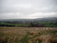
The weather had begun fairly brightly, but as the
path led up Ealingham Rigg heavy grey clouds took over and a chilly breeze made
its presence felt. At the top of the hill I stopped to wrap a scarf around my
neck and have an attempt at readjusting the uncomfortable boot.
 |
Shitlington Crags
|
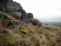
The prominent rocks of Shitlington Crags were the
next landmark, followed by the muddy Shitlington Hall (Wainwright called this
name "a trifle earthy" - it was originally "Shotlyngton Hall"). Navigation was
becoming more complicated as there are more small fields around here and PW
signs are not abundant. I had to find a way through a barbed wire fence after
taking a wrong decision, but was soon crossing the Houxty Burn and up a steep
hill onto Wark Common.
 |
Lowstead
|
A lane led to more open ground, then another lane
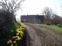
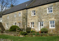
led down to the beautiful, sheltered farmsteads of Linacres and Lowstead,
resplendent in morning sunshine and spring flowers. The Way passes right through
the garden at Lowstead, which was quite a haven after the bleak uplands I'd been
getting accustomed to. After another mile I was crossing Warks Burn by a scenic
footbridge, the sunshine and vegetation giving a fair impression of a summer
day.
 |
Lowstead
|
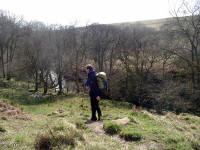
Just beyond the Warks Burn I stopped to remove
the scarf and the by now painful boot. As the left boot was completely
comfortable I was loath to interfere with it, so I exchanged the right Meindl
for the right Brasher and walked on in odd footwear.
 |
Descending to Warks Burn
|
The next section was back to upland country with
a slog up the hillside to the north Wark Forest. A good track then leads through
the forest to a road near Willowbog, then through more forest to open ground on
the Black Law ridge. A grassy open section with only a faint path then heads
south-west to the edge of another plantation. I was now 10 miles from
Bellingham, at 12.39 p.m.
This plantation is Wark Forest South, the last of
the forestry sections on the Pennine Way. On leaving the plantation, the
landscape suddenly opened out with two ridges ahead, one of them the famous Whin
Sill with the Roman Wall on top. The approach to the wall seemed very long
although only a mile and a half from the edge of the forest. I had not been
walking smoothly, and the painful ankle did not help: I was wishing I'd removed
the Meindl boot earlier as the Brasher was rubbing the sore area left by the new
boot. By the time I reached the top of the wall, I was feeling quite weary and
didn't really relish the sharp undulations I was expecting along the next few
miles.
 |
Hadrian's Wall, looking east towards Housesteads
|
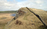
However, the weather had turned warm and sunny
(at last) and the views along the wall were superb. I'd made good time: I'd
arranged to meet Chrissy at Cawfield Quarry at 4 and this looked a reasonable
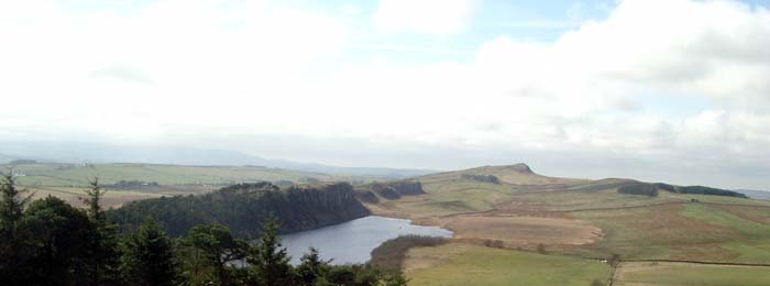
schedule with plenty of time to enjoy Hadrian's Wall. It was an enjoyable though
tiring 5 miles along the wall - it was good to see plenty of people enjoying a
stroll, and there were several highlights such as the aerial view of swans
nesting in the reed beds of Crag Lough.
 |
Looking west over Crag Lough
|
 |
The reed beds of Crag Lough
|
 |
Steel Rigg
|
I had considered waiting for Chrissy at Cawfields,
then walking on another couple of miles to reduce the mileage of the next day,
but the painful ankle and a general weariness led me to consider planning a rest
day instead of a shortened day as I sat at the Cawfields picnic site and waited.
There is no mobile phone reception at Cawfields,
and for once there was no sign of Chrissy. Half an hour went by and I drank the
last few drops of my water supply as I waited (no ice cream van,
unfortunately!). Eventually she appeared, having been confused by the roads from
Hexham and Greenhead, and we made our way to the next B&B, at
Broomshaw Hill Farm, just
north of Haltwhistle. This is another recommendation: a fine old farmhouse with
comfortable and spacious rooms and an air of grandeur.
We drove down to Haltwhistle in the evening, and
had excellent fish and chips in the parlour at the back of the chip shop - a
contrast with the previous night, but almost as good! We then had a quick pint
in an excellent small pub tucked away just off the market square: good beer and
a cheerful atmosphere made this one to recommend (although I forget the name -
it's the one behind the Indian Restaurant!).
289 miles completed
I decided to take a rest day, in fact I had two rest days, on 12th and 13th
April. The dilemma I faced then was whether to continue from where I left off
(i.e. Cawfields), or continue from where I should have been by then (Dufton). I
went for the latter option as this had the advantage that I didn't have to
re-book accommodation. The down side was that I'd have to leave a gap of about
40 miles, which I'd have to walk later. I didn't want to do any section out of
sequence, but felt that this was the best compromise.
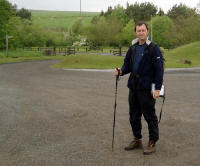 |
Setting off from Cawfields
|
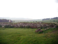
|
One of the last sections of Hadrian's Wall
|
So I returned on Saturday 29th May to fill in the gap - it's easier for the
reader if this is fitted into geographical sequence, however. This time we used
the Douglas to Heysham ferry, arriving in Heysham at about half past eleven in
the Friday night. We stayed in Morecambe for the night, then drove the 90 miles
or so to Hadrian's Wall in the morning. This meant quite a late start: it was
10.35 before I was under way again from Cawfields picnic site. I started walking
in light drizzle, but the weather soon picked up and the waterproof trousers
were quickly jettisoned in favour of shorts. An enjoyable four miles led up and
down the fading escarpment to the ruins of the 14th century Thirlwall Castle,
which overlooks a few beautiful cottages nestling in a dale. Busy looking at the
castle, I made a navigational error here which led me down to the hamlet of
Longbyre, adding half a mile to the route as I had to walk back along the road
to pick up the PW again. I'd asked a ranger for directions at the castle, but he
didn't seem to know which way the way went at all - I'd already missed the
turnoff by then.
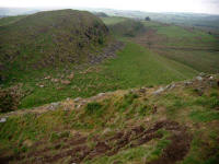 |
The switchback path over the Whin Sill
|
 |
Thirlwall Castle
|
The path led steeply up from the road to Haltwhistle Golf Club, and across the
course itself. A friendly golfer gave me directions to negotiate the fairways,
and by half past twelve I was crossing the A69 - a very intimidating stretch of
busy road. A good track led up the hillside through light woodland, to a turn
down a bleak lane. I cut the corner slightly by walking through a field of
cattle: only when I approached the bull did I notice it. He was a big fellow,
but no horns and I continued warily, assuming that the bull could not be too
dangerous if left grazing next to an unfenced footpath.
I was glad to get over the gate and out of the field, however, and on to the
more familiar Pennine upland of Blenkinsopp Common. For the next few miles the
path was faint and the ground rough: featureless grazing land. Wainwright called
the next section "tedious and complicated": you're not inspired by anything, but
you have to maintain vigilance to navigate efficiently through the fields on
vague tracks. I stopped for lunch (of Kendal Mint Cake) at Batey Shield, a farm
about nine and a half mile from the start. It was sheltered and warm, but I had
to retrace my steps for about 50 yards as I'd missed another turnoff.
 |
Stile on Lambley Common
|
After another mile and a half, the ruins of Lambley Colliery appeared, and I
crossed the A689 onto Lambley Common. The Way crosses heather moorland here: the
hills have risen up again after the crossing of the gap between Cheviots and
Pennines, and at last I was genuinely in the Pennines. The track follows the
Roman Road (Maiden Way) for a few miles of fairly uninteresting but
straightforward walking, then drops down under the railway viaduct at Burnstones.
The next section to Slaggyford was very complicated to find, so it was slow
progress - if the Way had been amended here to follow the railway track it would
have been much improved. Despite the grim sounding name, Slaggyford is a very
pleasant village, although without facilities. A good riverside walk along
summery meadows then led to another railway viaduct at Lintley.
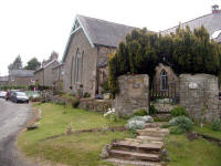 |
Slaggyford
|
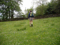 |
Approaching the A689 near Kirkhaugh
|
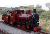 |
Steam engine on the South Tynedale railway
|
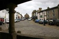 |
Alston centre
|
Here the PW takes an undulating parallel course to the railway, and I opted to
walk along the disused track bed itself - much better. There were hundreds of
rabbits in sight as I marched along to the existing steam railway station at
Kirkhaugh. Here I crossed an unstable-looking stone bridge to rejoin the
official route for a short distance. On reaching the main road, I transgressed
again: after 19 miles I didn't really see the point of the diversion up the
hillside and back down again, and kept to the road until the Way crossed the
road again at Harbut Law on its way down to the South Tyne. A gentle walk along
the river bank then led easily to the bridge at Alston and the waiting Chrissy
(I was five minutes late).
 |
View from High Windy Hall
|
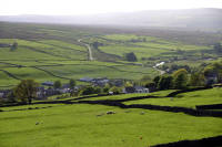 |
Garrigill from High Windy Hall
|
We stayed that night at the best place so far:
High Windy Hall. We had a superb room
with a balcony overlooking the Garrigill valley, and on a fine calm evening we
had the windows wide open and could hear the shepherd bringing in the local
flock. Dinner was superb, with a table looking out to the setting sun over Cross
Fell. The couple we chatted with were interesting as well: the lady was rather
elderly and infirm, but clearly frustrated that she could no longer climb the
mountains she still loved.
Chrissy dropped me off back at the bridge over the South Tyne at Alston:
although we stayed only a short walk from Garrigill I couldn't cut out the four
mile walk up the valley - I might not be pedantic about the continuous walking
but I want to avoid leaving any significant gaps, as I enjoy the feeling of
having made the whole journey on foot. As we were heading south after today's
walk (by car, I mean!), we arranged to meet at the pub in Dufton at four
o'clock. As it was after nine by the time I set off towards Garrigill, and with
the highest hill in the Pennines on the itinerary for the day, I had to take
advantage of the straightforward section to Garrigill. This was a pity, as the
valley is very attractive here, and the weather was warm and sunny.
Although the route looks very simple on the map, it's a little confusing in
places and I wandered off the footpath a couple of times. The crucial footbridge
was found fairly easily, though, and I was welcomed to the outskirts of
Garrigill by a couple of herons. On such a fine morning, even the spoil heaps on
the edge of the village seemed pleasant, and the village itself is quite a gem,
with a lovely big green surrounded by well-tended cottages.
 |
Garrigill
|
It was tempting to dawdle here, so it was a good thing that it was too early
for the pub to be open. Actually, I was keen to get on with the ascent of Cross
Fell: a mountain which has been on my list for a very long time. I was expecting
a hard climb for the first couple of miles, but in the event the track was good
and the gradient steady and I was soon up on the wide open space of Long Man
Hill.
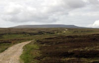 |
The track over Long Man Hill, with Cross Fell behind.
|
The next few miles were a steady grind on a fairly level gravel track. The
only difficulty was that the track surface consists of stones which have been
loosened by the passage of vehicles so that footing is often awkward.
A sudden rise led to over the magic 2000 foot mark, and the track contoured
round at about 2300 feet until the prominent shelter of Greg's Hut: part of one
of the many old lead mines around these slopes.
 |
Greg's Hut
|
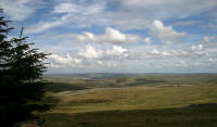 |
Looking north from Greg's Hut
|
Here the peaceful scene was interrupted by a group of bikers - I guess the
reason for the track being so stony. The group stopped at Greg's Hut, and I
feared that they were going to head for the summit but luckily I never saw them
again after I left the hut. There were plenty of tracks and gouges in the wet
hillside above, however, and it's obvious that Cross Fell is a popular
destination for the bikes. Elsewhere I have a
special web page with examples of how the Pennine Way is being destroyed by
off-road vehicles, so I won't rant about it here!
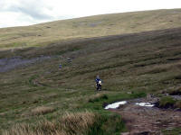 |
Arrival of the bikes
|
A laborious mile from the hut and I was on the summit of Cross Fell. It was a
good, clear and bright day and the view across the Eden Valley was spectacular.
Although the summit is flat and dull, you have a feeling of being on the roof of
the Pennines, as this is the highest point at 2930 feet (893 metres).
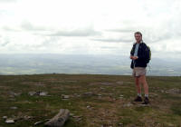 |
At the summit
|
I took a direct line towards Tees Head from the top: the path actually goes
east before dropping through the screes, and I ended up having to cross an
awkward bolder field to reach it.
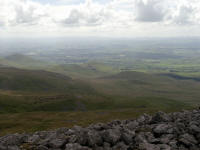 |
View from the boulder field
|
The path along the ridge to Knock Fell was a very enjoyable, airy experience
with great views of the populated lowland on the right and the vast wilderness
on the left. the path here was very popular as well - I'd only seen one walker
from Garrigill to Greg's Hut, but now I was passing people all the time. Soon
Little Dun Fell was crossed, and the desecrated Great Dun Fell loomed.
 |
Great Dun Fell from the summit of Little Dun Fell
|
The path skirts the radar station, and reaches the road just to the
south-east.
 |
Great Dun Fell
|
Perhaps one day the fell will be clear of its paraphernalia, until then we
have to tolerate it. At least it means that England has a high road - the road
here is tarmacced, and joined briefly at the height of 2500 feet.
Knock Fell is more typical of the Pennines, a rounded peaty lump. The path
turns south west here, to a prominent cairn on the edge of the descent to Knock
and Dufton. I stopped for fifteen minutes at the cairn, removed boots and socks
and treated a few area that were starting to rub a little. This was a good move,
as my feet then felt perfect and I ran down the hill. I was at the cairn at 2.40
p.m., and two miles further on at Swindale Beck by 3.05 after a very enjoyable
wild scamper down the hillside. The beck must have enormous spates as it was a
huge area of gravel with hardly a trickle at the bottom.
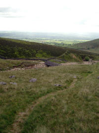 |
Swindale Beck
|
From here the Way became less and less rugged, until I arrived (in a shower
of rain) in the leafy fields on the edge of Dufton. I made it to the village
green by four o'clock, where I met Chrissy and we had a drink in the village pub
before setting off for South Wales (the Third Division Playoff Final was the
next day and couldn't be missed!).

